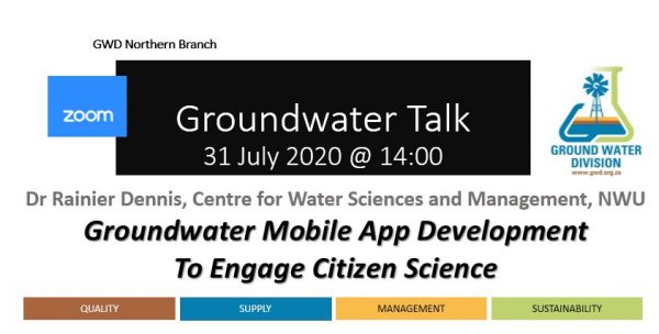
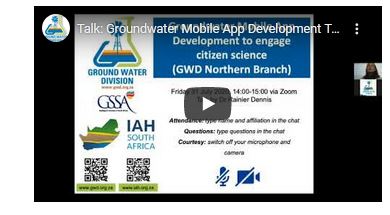
Event Debrief: Groundwater Mobile App Development To Engage Citizen Science (GWD Northern)
Event Debrief: Groundwater Mobile App Development To Engage Citizen Science (GWD Northern)
SACNASP CPD EVENT
Well done to GWD Northern Branch as this excellent presentation by Dr Reinier Dennis are inspiring and really bring a colourful and interesting pun to the words "Watch this space".
ABOUT THE PRESENTATION:
Public domain borehole information in South Africa is generally stored in the National Groundwater Archive (NGA) and the Groundwater Resources Information Project (GRIP) databases of which both are centralized databases. The GRIP database is updated by the Department of Water and Sanitation, but only covers one of the nine provinces. The NGA on the other hand covers the entire country, however there is a backlog of borehole information that needs to be captured, and it has limited time series data.
The reason for the poor time series data is two-fold:
(i) groundwater monitoring is expensive due to the distributed nature of the resource (the NGA consists roughly of 280,000 boreholes over 1,225,986 km2) and
(ii) consultants tend not to upload data to the national databases as the data is seen as a competitive advantage.
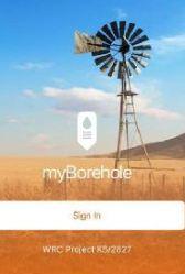
During the recent drought experienced in the Western Cape Province (2015 to 2018), citizens of local communities took to social media, reporting on rainfall and groundwater levels within their communities. With the dams drying up people started targeting groundwater with the result of approximately 30,000 boreholes being drilled. This led to the development of a mobile app available to both citizens and groundwater professionals. This app allows logging of borehole information via smart phones. One of the main challenges with populating databases is the verification of the data.
The mobile app introduces a type of block chain approach where all data is accepted, but marked as low confidence until verified by a trusted user. The vision for the app is a ‘live’ hydrocensus and even if only water levels are captured, it would improve groundwater management by applying data mining techniques for trend analysis.
ABOUT THE SPEAKER:
Rainier Dennis (BSc IT, BEng Electric & Electronic, MSc Geohydrology, PhD Geohydrology) is a senior lecturer at the Centre for Water Sciences and Management, North-West University. He has more than 18 years’ experience in software development, hydrological and geohydrological investigations.
TALK RESOURCES:
We appreciate the sharing of the materials and we trust that Dr Rainier will receive a lot of additional inquiries around this inspiring development.
Recording available via GWD YouTube Channel
Q&A SESSION:
Transcription
Ivo: Is the code open source? if so pointers please
Once the App is complete, the code will be handed to the WRC and eventually to the custodian of the final database to make sure that if there are changes or future development, they can work with the existing code. So yes, it will be open.
Erin: What is the data consumption like?
Quite a difficult one. I think the best way is what Rob Schapers have said and that is he will start to track data usage as soon as the pilot version goes live. If you are worried about consumption the best thing to do is, at the office, download the data for that specific area so that the base map tile will be cache to your phone together with the borehole data that is available for that area. You can then go offline with your device and your GPS positioning device will still work in the field. You can log all the information and once you get back to the office you can connect to your Wi-Fi or any device you use and it will be uploaded. We will do some benchmarks in terms of just normal run-of-the-mill operations.
Irene: Two questions: (1) Has the feasibility of linking this to water use licenses/registration been considered to populate the database. And (2), will there be a function to convert what3word coordinates to surveyed data for use by groundwater professionals?
The first question concerning water use licenses, no, we haven't considered this. My guess would be if people would be using it they may see the applicability and we might get some more requests to add this type of functionality - it is a good idea. The second question, yes on the use of the what3words. It can convert either way – by the coordinate of the block or the what3words can take you to the center of the block but remember, since this is a GIS system all those boreholes that you see on your display already has its own latitude longitude built-in so, it is not really necessary to convert back from the what3words as the GIS already have a coordinate for each site.
Nico: Is there some security measures in place to prevent the public to be targeted, due to location and photo sharing. Some chap might be interested in high-jacking your pump and sell on the black-market, if your borehole is not properly secured.
Yes, obviously there are certain things and this is a very valid point. We’re also sitting with the POPI – the Protection of Personal Information Act so you can't publish owner’s details and so forth. That is something that we obviously need to take cognisance off and being aware of this for some time, we don't have a solution yet. You can obviously strip the GPS and location details from any image but if you have the phone and you’ve registered on the App., obviously you can see there is a borehole and it’s got a pump in it, so, yes that might be a concern.
Wilbè: Wouldn’t it be better to develop the apps natively? If the source code is available I could assist in writing a MAC desktop version if there are any mac users
At the end of the day what the App studio does, is when the QML (Qt Markup Language) is compiled it invokes the relevant c++ compiler for each target platform, so in essence what you end up on your phone is a native app. The only reason why we have used the Arc products is because we are making use of ArcGIS online and you can also run some analysis of the data from the ArcGIS online server and then eventually make that analysis also available to users. If you were to develop that from scratch it would be a massive undertaking.
Jorette: Great project! On some projects we used to overlay the NGA, WARMS and whatever data we could over Google Earth to assist with hydrocensus investigation in the field, but phone battery dies and doesn't always show your position in relation to the nearby boreholes. Have you had similar problems or lags?
I suppose this will depend on your specific device. In our testing we have not come across this, but to date we were only using an iPhoneX and a LG V20 in our testing. When you disable the data network on our app, assuming you have cached all the data for your study area, you will conserve power and lengthen your battery life. I am not sure if Google Earth provide the same functionality to save battery time. It is also worth mentioning that GPS accuracy on a mobile phone, only making use of GPS (no Wifi) out in the open can range from 1m to 5m. This accuracy can be increased if making use of external GPS antennas, but from a citizen science point of view we don’t expect users to do this. Some phones support high accuracy mode which is switched on in the Settings menu.
Please contact Dr Rainier Dennis or Prof Ingrid Dennis for more information on this subject: Prof Ingrid Dennis <[email protected]>, Rainier Dennis <[email protected]>