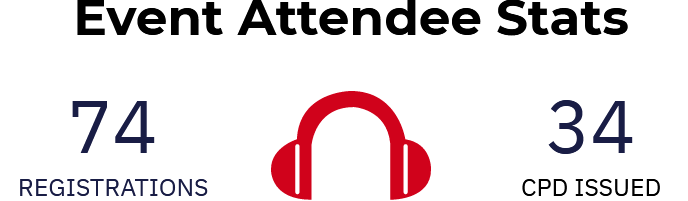
Event Debrief: Q3 GAKZN & UKZN webinar: Presenting on Groundwater Research
Event Debrief: Q3 GAKZN & UKZN webinar: Presenting on Groundwater Research

The GAKZN Webinar hosted, in association with the GWD and the University of KwaZuluNatal, had two speakers presenting on current research findings:
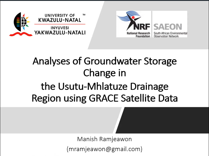
Presentation 1
Talk Abstract:
The Gravity Recovery and Climate Experiment (GRACE) satellite data interpretation provides an integrated measure of monthly terrestrial water mass changes. The GRACE satellite data has been successfully used to estimate the monthly changes of terrestrial water storage (TWS) including groundwater storage changes. This presentation will provide an overview and application of the GRACE satellite product to determine the groundwater storage changes in Usutu-Mhlatuze Drainage Region in north eastern South Africa.
 About the Speaker:
Manish Ramjeawon is a Hydrology Ph.D. candidate from the University of KwaZulu-Natal. His current research interest involves the impact of land-use change on surface water and groundwater resources in northern KwaZulu-Natal.
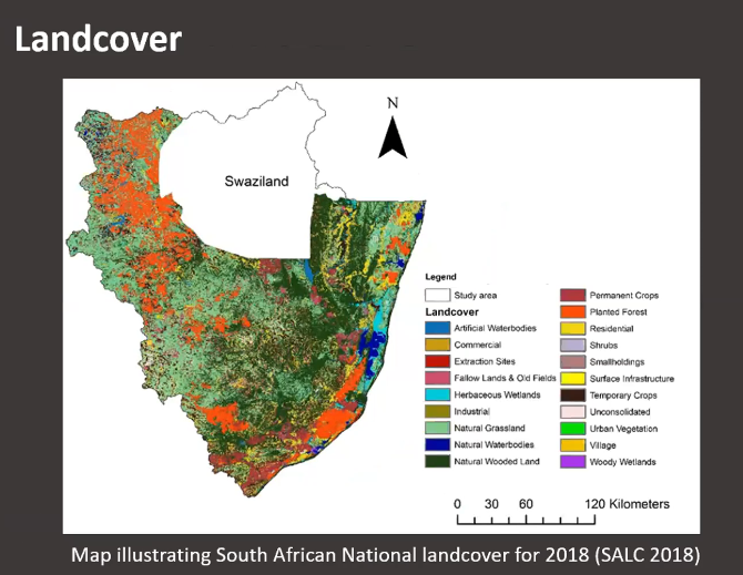
GRACE, GRACE-FO, Modelling, land-use, Usutu-Mhlatuze Drainage Region, monthly images, surface water data, 3 lakes, eastern coast, 9 dams, global land data simulation, NASA, resolution, GLDAS, soil moisture, NOAH land surface model (LSM), storage, anomalies, mean 2002-2009, trend 2002-2006 decrease, DWS, variation, 2017-current steep decline, 2017-2018 gaps in data satellite, not operational, cloud cover, general trend, consistent, soil moisture anomaly, between 2014-2019 decline water levels, the purpose of study, primary, secondary aquifer, storage for the catchment, steep decline to 2020, groundwater storage, deviation of the mean, size of the secondary aquifer, decreased groundwater storage. Institute data, groundwater monitoring data, DWS stations, compare with GRACE on primary, similar trend, WMA, decreased rainfall, land-use, commercial forestry, eucalypti, 1000 hectares per annum and 35% drain, Lake Sibaya. Limited groundwater monitor stations, GRACE potential
Thank you to my research supervisors
Dr Molla Demlie - [email protected]
& Dr Michelle Tosha
Funders Acknowledged.
Presentation 2
Talk Abstract:
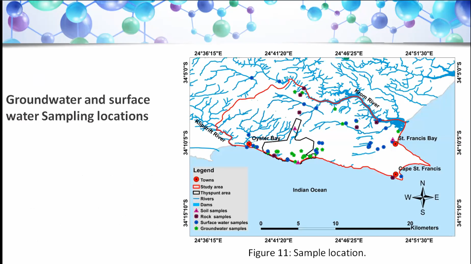
This presentation highlights the results of the development and the calibration of a steady-state and transient three-Dimensional numerical groundwater flow modeling based on a robust conceptual hydrogeological model of the area. The calibrated transient numerical groundwater flow model is further used to understand the advective transport of a hypothetical contaminant released from the site of a proposed nuclear power facility at Thyspunt. The information gained from the numerical groundwater flow and advective transport models help to understand the background hydrogeological conditions to be used as input in the environmental impact assessment and as a reference for future post development conditions of the area.
About the presenter:
Mr Moneri Joel Modiba is a young professional hydrogeologist. He is a member of the GSSA and worked as a geologist at the Marula Platinum Mine. He holds a BSc honours Degree in Geology from University of Limpopo and a MSc Degree in Hydrogeology from the University of KwaZulu-Natal.
Three-dimensional, numerical modelling, testpump area, nuclear station, EIA required, conceptional groundwater flow, hydrological condition, contaminant transport, isotope analysis, study advective transport, eastern cape, 120km west PE, high rainfall, winter, topography, 2 drainage systems, rivers, highlands to Indian ocean, meta-sedimantary rock, metholotic interconnect, geology, TMG fractured, outcrops, preferential pathways, intergranular, aquifers, fractured, less productive than, methodology, climate data, earth data, hydrostratigraphic unit, chemical, trace elements, iron oxidation, robust, 3d model, calibration, converted, advective transport model, hydraulic parameters, arteasian borehole, chemical, PH, EC, classification, fresh water, iron in mix, seawater and surface water, evaporation, tritium analysis, modern water, older water, software, Thyspunt, MODFLOW, upstream package, 2 layers, 2 formations, deepest borehole with constant elevation, pumping, model domain, specified head, model grid, top elevation, steady state, conversion, calibration test, water budget, total inflow, successful model, head distribution, relationship, similar observed, simulated, good fit, simulation, transient, forward particle, flowpath, injected, particles, indian ocean, future, proposed footprint, reversed, tracking, no seawater intrusion, domain, transport, tracking, recommendation, robust, mean absolute error, 4 decades, reach ocean, ongoing monitoring
Special thank you to Prof Demlie and Prof Tumara.
Funders and hosts acknowledged.
Discussions
Talk 1 Q SN: Thanks Manish. Would like to please find out if there is any correlation with the lack of flood releases from Pongolapoort Dam (fills numerous pans) and groundwater recharge, probably focusing on the secondary aquifer.
Manish: Did not look into flood lands and correlation with data that I have. I will let you know if I find anything on that.
Talk 2 Q PR: An EIA has already been done for this site, including a groundwater specialist report including modelling? References - EIA specialist report missing?
MD responds: This study is independent of what has been already done. The researcher was not allowed to refer to the EIA.
Talk 2 Q PR: Figure 20. Conceptually, recharge is postulated to flow from the higher lying TMGA of the Kareedouw Mountains towards Cape St. Francis. Therefore not sure about the no-flow boundary across this area?
Moneri: I think the reason we assigned a north flow boundary from that area. We don't have (e.g. rivers) a groundwater divider that side , it was done not to allow water into the model domain.
Talk 2 Q PR: How were the aquifer parameters such as T and S derived - from test pumping or from previous work? Why not do advective transport from the proposed nuclear installation footprint?
Moneri: They were derived from pumping tests. Pumping test data analysis done by the research from data provided by NNR. Data that were already done in the field. Vector transport from Nuclear footprint was done but not included in the presentation.
Mr. Pieter Labuschagne noted that these regular science sharing sessions are of great importance, arranged quarterly by the/ with the students & branch support, and thanked all that attended.