Webinar
3D Geomodelling Webinar (GSSA)
Recent trends in mining and exploration are set to further accelerate the demand and growth of 3D geological modelling software. These trends include the inevitable increase in cost per ton of resource and global economic slowdowns. These require companies to constantly cost-cut during extraction and to improve resource delineation. Add to this the trend that new discoveries are deeper and in more structurally-complex setting, and it’s apparent that a great deal of attention needs to be focused on getting the geometry of a deposit, as early as possible in the exploration and mining value chain, correct.
21 Aug 2020 07:30 - 21 Aug 2020 15:45
Event description
Recent trends in mining and exploration are set to further accelerate the demand and growth of 3D geological modelling software. These trends include the inevitable increase in cost per ton of resource and global economic slowdowns. These require companies to constantly cost-cut during extraction and to improve resource delineation. Add to this the trend that new discoveries are deeper and in more structurally-complex setting, and it’s apparent that a great deal of attention needs to be focused on getting the geometry of a deposit, as early as possible in the exploration and mining value chain, correct.
About this event
The versatile application of well-built, validated 3D models is one of the most important tools for achieving this and forms the basis for all downstream processes. From the point of view of drillhole targeting,resource extension, geotechnical design, infrastructure and cost simulation, pre- and post-blast surveying, geohydrological simulations, truck and bucket volume calculations and many other routine mine tasks, 3D models are a common and necessary denominator.The past decade has seen a tremendous growth in the capabilities of almost all commercial 3D geomodelling packages, to the point where they run on high-end PCs. This growth has changed the complexion of mineral exploration and mining; there is now a huge overlap in terms of basic volume modelling and manipulation between commercially-available, general modelling packages and those specifically tailored for use in geology and mining. Recent trends are away from software packages that have unforgiving data import routines, use explicit, section-based modelling and which incorporate limited data sets or types. The trend is towards software packages that have flexible import routines;rapid, dynamic, implicit modelling of surfaces and shells, integration of large numbers of disparate data sets and 3D querying of spatial data to determine trends and patterns. These typically incorporate an easy, workflow-driven approach.
WHO SHOULD ATTEND
- Geologists (mainly Junior, Mining, Exploration, Hydraulic,Engineering, Resource)
- Exploration Managers
- Geotechnical Engineers (Engineering Geologists)
- Surveyors
- Mine Planners
- Academics (Professors, Lecturers in Geoscience and Geology Departments)
- Consulting Companies
- Mineral Resource Managers
- Mining Engineers
- CEOs
REGISTER HERE (note: link to an outside site)
Speakers

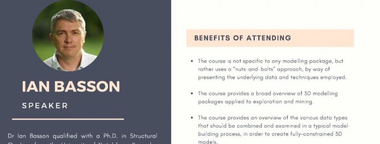
Ian Basson
Professional Structural Geologist Topic: 3D Geomodelling
Qualified with a Ph.D. in Structural Geology from the University of Natal (now Kwazulu-Natal) in 2000. He completed his Post-Doctoral Studies at the University of Cape Town, with a focus on the structural controls on kimberlite emplacement, in 2002. Ian is a professional structural geologist with over 20 years of experience in mapping, structural analysis, and 3D modeling.
3D Geomodelling Webinar (GSSA)
21 Aug 2020 07:30 - 21 Aug 2020 15:45
Webinar
Can't find what you're looking for?
Get in touch with us and let us know how we can help